Sunday, August 30, 2015

The Return to Wetterhorn (Reflecting on the Summer and Revising Thoughts of the "Wilderness Experience")

“We simply need that wild country available to us, even if we never do more than drive to its edge and look in”

—Wallace Stegner, 
the “Wilderness Letter” for the Outdoor Recreation Resources Review Commission / The Sound of Mountain Water

View of Painted Wall from the North Rim

On the second day of orientation for new seasonal employees, having already learned about safety, personnel, management, and the overall NPS mission, we were briefed on park-specific resources and founding purposes: water, ecosystems, history. Wilderness.

“This is the closest many people will ever come to wilderness,” the ranger said of the scenic overlooks at Black Canyon, “Anyone can just drive up and see it, right there.”

I involuntarily gasped and must have grimaced.

She turned to me and, acknowledging my look of incredulity, proceeded to explain: those who are physically incapable of trekking through rugged terrain, unequipped to navigate great distances, and/or prefer not to experience the tiredness, soreness, and inherent danger that accompany long hikes into distant places have at Black Canyon a unique opportunity to drive right to the edge of the deep, narrow chasm and gaze down into the heart of a capital-W Wilderness. They can see it up close.  They can feel the heat rising from the rocks, the coolness emanating from shadows. They can smell the sage after rain, juniper baking in hot sun.  They can hear birdcalls echoing, wind rustling, and, of course, the river—the river roaring, rushing, tumbling on down between the rock walls, several thousand feet away but ever so close, ever so wild.

View of the canyon from the North Rim, colors sharp after a rainstorm

True. And yet…

Not knowing whether the ranger’s original statement had used a generic term or proper noun—“the closest they’ll ever come to [a federally-designated] Wilderness [Area]”?—I continued to wince, writhe, wring my hands as she continued to describe the park's attributes.  Even if her points were technically right—yes, most park landscapes still have some trace of man (trails, if not roads and buildings); yes, many Wilderness Areas are seen from too far away to be understood and appreciated; and yes, individuals all have different perceptions of wildness—something in me protested that standing at a pull-out ogling a place doesn’t count as truly experiencing it.  “What of the humility, the fear?” I wanted to ask, “What of awe? Do visitors feel vulnerable, exposed? Small, self-reliant, fully alive out alone in a big, wild place?” 

I barely managed to keep my mouth shut—it wasn't the appropriate time or place for a debate. Instead of arguing (Ed Abbey [The Monkey Wrench Gang]: “Challenge that statement.  I challenge that statement. With what? I don’t know”), I scribbled fiercely in a notebook.

Now, three months later, I’m looking at my notes and still wondering if and how to challenge that statement. Assuming that experience nurtures appreciation and informs preservation, can muted experience still inspire strong appreciation? Does flattened or dulled appreciation lead to weakened preservation?  Does the “wilderness idea” need more preachers or more defenders?  What experiences are visitors to Black Canyon absorbing, learning, taking away?

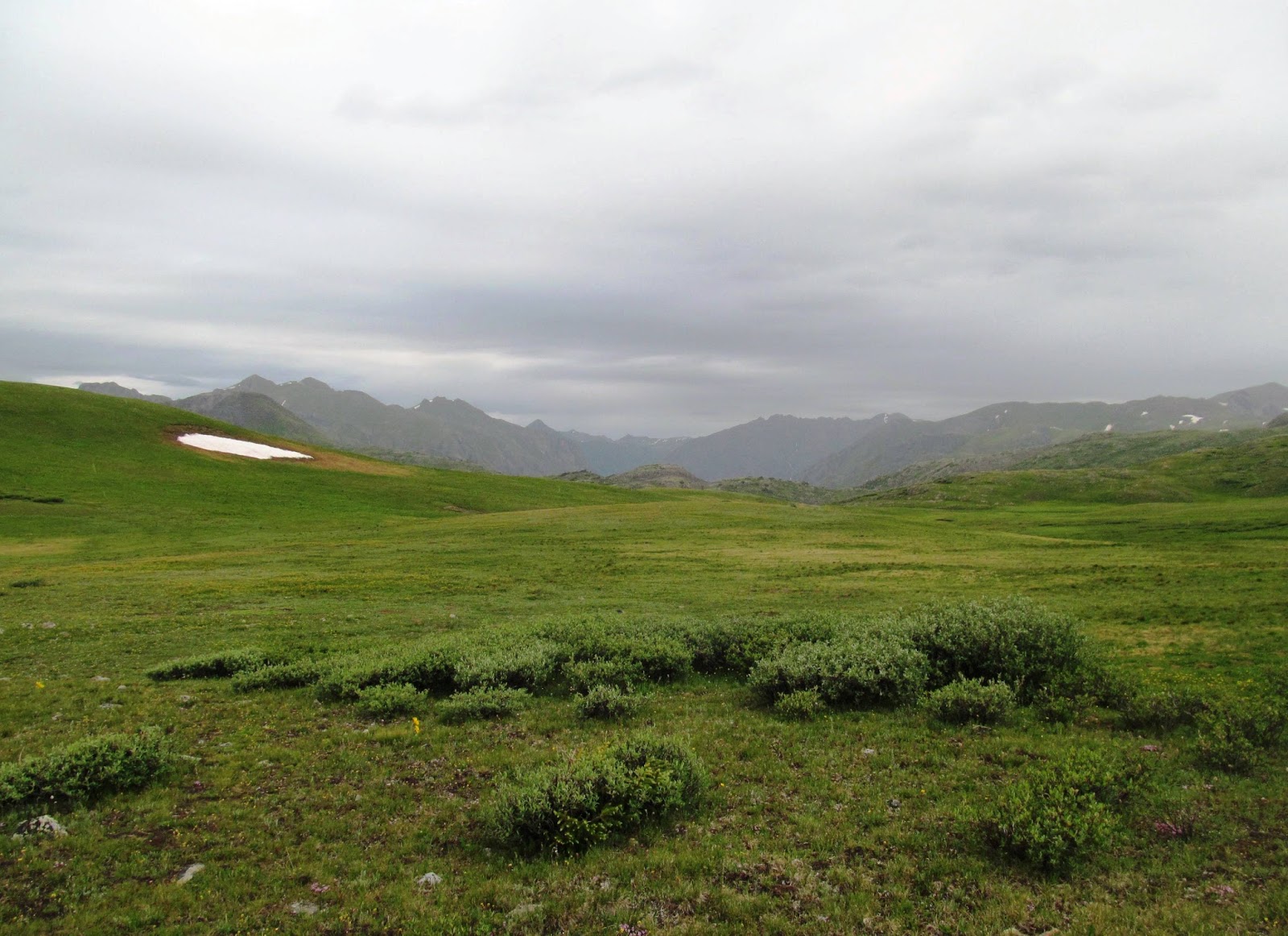
How to tell whether you're in a park service wilderness or on BLM rangeland
****

For that matter, what did I see, do, and learn this summer?  

U.S. Forest Service Wilderness Areas (Sneffels, Weminuche, Wetternhorn): Snow, rock, flowers; dogs, tents, people. Steep, challenging, breathtakingly beautiful—cool blue pools nestled in the alpine tundra, reflecting rocky ridges—but trails are not wilderness. I saw more wooden signs than signs of wildlife, met more people than wild deors, never quite felt free to wander. Plus, I felt guilty for having to drive so far to hike.

Pool near Upper Ice Lake (technically not a Wilderness, but pretty.)

 Wilderness Areas in Black Canyon (Red Rocks, Green Mountain, Grizzly Ridge) and backcountry Curecanti: steep sandstone ridges and incised mudstone ravines. Prickly pear, sagebrush, darn thick scrub oak and serviceberry. Fossils! Although the far-flung corners of the parks—remote, rugged places few people were ever likely to go—seemed wild (especially when great murders of ravens would start circling, as if to craw, “what are you? What are you doing on our cliff?”) and I was acutely aware of being alone—my muscles weak, skin thin, and bones breakable—I was also quite conscious of the facts that I was carrying a radio, GPS, maps, rock hammer, first aid kit, water, etc., and that I was there to work, not sit and absorb the landscape.
 
Folds of fossil-filled sandstones and mudstones

The park road: stars, solitude, surely mountain lions watching from the brush. Striding along through the early morning darkness with the Milky Way arcing overhead, solid pavement underfoot, and susurrations of the river rising up from the impossibly deep canyon, I came close to feeling untrammeled, but also felt safe and secure enough to be walking alone before dawn, wearing sandals and carrying no emergency supplies (aside from a thermos of coffee).

Sunrise, softly bringing the world into focus

Rock Point: sanity, serenity, wingbeats of wrens. I didn’t sit out there enough.

Rock Point. Yes, wildness, if not wilderness.

****

My final weekend in Colorado, I decided to return to the Uncompahgre Wilderness—the same route I’d attempted in early July, up the West Fork of the Cimarron aiming for Wetterhorn Basin, hopefully with less snow and far less snowmelt by mid-August.

This time, I knew to get an earlier start, carry a lighter pack, and follow the trail. My goal wasn’t to have a “wilderness experience,” but rather to make it over the pass into the basin, enjoying the fresh air and the picturesque views along the way.  I hiked at a fast but not grueling pace, pausing to marvel at the wildflower-filled meadows and stopping repeatedly to put on and take off rain gear. It took about an hour to get to the waterfalls (the spot that had taken nearly 4 hours to reach in July), then another hour-ish to weave up the mostly-snowfree center of the cirque. 

View down the West Fork valley, with less snow
Flowers!
So many flowers!
I kept telling myself to slow down and appreciate the day—bright sunshine breaking through as clouds began to clear; patches of blue sky appearing over rusty ridges; fat, golden marmots whistling from the rocks—but the pass drew me onward, upward. After a final push, I came over a crest of rock and moss and felt the landscape open out underneath me: a swoop of tundra and rock slid into a forested drainage; barren ridges rose back up on the far side. Beyond the basin: mountains, and mountains, and mountains.  I didn’t recognize any of their profiles or know any of their names, but I was awfully happy to see them.

Pass into Wetterhorn Basin

Intending to sit and soak in the scenery for a while, I left the trail and began rock-hopping in search for the perfect spot. I was concentrating so much on where to put my feet that I lost awareness of the larger landscape. It wasn’t until I’d dropped my pack and turned to sit that I realized, with a gasp, that I could see Wetterhorn Peak itself dominating the far horizon.

Some landmarks—Pilot Rock (Petrified Forest National Park), Fang Mountain (Denali National Park), Algonquin Peak, as seen rising up over Wright (the Adirondacks)—have a certain ineffable prominence or presence that draws attention and commands respect. Their size or height or aloneness makes them physical manifestations of awe.  Seeing them, it’s easy to understand why cultures worldwide have believed mountains to be the homes of gods.

Wetterhorn is one of those peaks.

Wetterhorn Peak -- the jagged tooth to the left

****

On the way back down (I didn’t stay long—feared the feeling of sacrosanctity would fade), I crossed paths with the first people I’d seen all day: two older women, friends who said they try to hike the trail (their favorite) together every year.  They were positively glowing, delighted to be out there and just as surprised and delighted to meet me—a lone girl from New York (New York!) who was also delighted to be out there, learning the trail’s twists and turns, celebrating its secrets, its marvels. We chatted briefly, then parted with wishes for lifetimes of “happy hiking!”

Grove of elephant flower (Pedicularis groenlandica)

Continuing down, I saw only one other group—a family of four, strung out.  The son, who was far in the lead, greeted me with a gasp of, “Did you do Wetterhorn?”

Rather than getting annoyed with the idea of peak-bagging or defensive of the fact that I’d “only” gone to the pass, I surprised myself by automatically and honestly replying: “Oh, no, thank you! I only wanted to see it.”  

It was enough to hike to the edge of the wilderness and look in, to know it's there.

Black Canyon Wilderness as seen from a bushwhack to the foot of Hound's Tooth.
Even if you never go there, you can, as Wallace Stegner wrote in the Wilderness Letter, "simply contemplate the idea, take pleasure in the fact that such a timeless and uncontrolled part of earth is still there." 

Thursday, August 6, 2015

Empty mind in misty, rain-pocked pools (Weminuche Wilderness)

Wherever I am, the world comes after me. 
It offers me its busyness. It does not believe 
that I do not want it. Now I understand 
why the old poets of China went so far and high 
into the mountains, then crept into the pale mist 
-- Mary Oliver, The Old Poets of China (in Why I Wake Early)

Highland Mary Lake, Weminuche Wilderness
It has become a weekly pattern: hike Friday, walk Saturday, sit Sunday. San Juans, park road, Rock Point; adventure, rhythm, pause.

During a late July “Adventure,” though, I made the mistake of simultaneously seeking “Pause,” or at least a day of restoration and touch of inspiration. After spending the work week clambering around hot, shrubby ridges and taking an informative but long trip to Florissant Fossil Beds, I wanted to escape to a place with cool air, open tundra, and, preferably, a calm, bright pool holding pockets of mirrored sky.  (Mountain lakes are both soothing and profound: according to David Hinton [Hunger Mountain], “ancient [Chinese poets and philosophers] recognized their most essential nature in such pools, for they saw empty mind in still water… an identity expansive as the mountain distances and bottomless skies it mirrors.”)
Island Lake, San Juan National Forest
Friends and guidebooks recommended Ice Lakes Trail, a popular route in the San Juan National Forest that leads hikers up to several of the area’s “most beautiful” blue lakes, nestled in the “most scenic” of tundra-carpeted and waterfall-ringed basins. ( http://www.hikingwalking.com/destinations/co/co_sw/silverton/ice_lakes )  Hoping to avoid crowds (and road construction), I left home at dawn and was at the trailhead by 8 a.m.  Although the parking area was, at that point, nearly full, as were the nearby South Mineral Campground and the “dispersed camping” sites alongside the access road, only three couples had signed the trail register ahead of me that morning.  (It turns out that the sign-in sheet is not an accurate count of actual use—I met 13 people in 6 groups on my way up.) Eager to be by the shores of a lake (and needing to warm up a little—the temperature in the shade was an unexpectedly chilly 39 degrees), I zipped right on up a series of forested switchbacks, across a few sunny meadows, and past those other hikers without stopping to chat, appreciate any of the scenic vistas, or contemplate the experience of the climb. Destination-bound: Lower Ice Lake!
Lower Ice Lake Basin

Nearing Upper Ice Lake
Um, I never saw Lower Ice Lake, though.  Sometime after I’d emerged into a wide, calendar-photo-style meadow bursting with wildflowers and ringed with waterfalls, I saw a spot of unnatural color out of the corner of my eye—a tent. A bunch of tents. They drew my attention to a small grove near a small stream that fed into a large, dark pond that I think was the lake, well behind and below.  Rather than backtrack and tromp through those people’s campsites to get to the water, I continued on, following the trail through the lush meadow, across a tumbling brook, and to the base of the falls-forming cliff, catching sight of several more tents along the way. Uncomfortably aware of how visible I was to all the campers in the basin, I hustled and huffed up the next set of switchbacks toward Upper Ice Lake.

I guess I’d presumed that this hike would be similar to Blue Lakes—busy at the lower lake but nearly deserted at the upper. As the trail led me away from the tent-filled meadow and steep, shrubby switchbacks toward a crest of Alpine tundra, I felt a warm mix of relief and anticipation—relief that I'd finally have some solitude and eagerness to see Upper Ice Lake, maybe nestle into a quiet seat for a few hours, watch the clouds and wait for marmots.
Upper Ice Lake
Anticipation and, worse yet, expectation can be ruinous. The lake was undeniably beautiful—turquoise-blue glacial water reflecting moss-carpeted hills, a bowl of rock-and-snow ridges, and, beyond them, a few happy cumulus in a deep summer-blue sky.  The weather was perfect, the day still young, I felt alive, beaming with mountain joy. But a sploosh broke the serenity. A kid had thrown a big rock into the lake, sending out ripples that broke the reflection. Then a dog jumped in after the rock. Then a dad yelled at the kid, another child’s voice chimed in...

I meant to skirt their campsite and find a quiet place to sit, but ran into a couple cooking breakfast outside their tent. Another tent was perched high above the opposite shore—was there nowhere left to go?

Without really knowing where I was heading, I followed a herd path to the south, crossing swells of open tundra and a few small snow patches to what turned out to be Fuller Lake. It was more rugged than serene--chunks of ice floated on its surface; snow and rock were sliding down from sharp peaks; what looked like a deserted miner's cabin sat rusting on its shore.  I should have just stayed there, watched the ravens and hoped for pikas. Instead, though, I got greedy. After spending just a few minutes rock-hopping around for better views, I decided to hit another lake before lunch. (Four in one day! Instead of peak-bagging, I was bent on pond-bagging!) 
Abandoned shack on Fuller Lake
Skim of ice on Fuller Lake
I returned to Upper Ice Lake (already busier) intending to hop the outlet stream and catch the trail to Island Lake.  When I saw a group of 5 begin the climb ahead of me, I was so disappointed that I almost left. 

I can't explain why I don't enjoy wild places when there are other people there. Selfishness? Jealousy? Pride?  Why does the Wilderness Act specifically mention "outstanding opportunities for solitude" as one of the critical components of the wilderness experience; why do wilderness managers focus on "solitude" as one of their key criteria? What is so fundamentally different about enjoying a lake or a mountain or a canyon alone vs. with hordes of other visitors, or even just a few?

Maybe it's that the presence of other people breaks an individual's connection with a place. Instead of getting to dissolve into a landscape, giving undivided attention to the rocks, the water, the brush, the birds, we can't help but be conscious of other humans, losing a little bit of our environmental awareness and getting distracted by a heightened sense of self-consciousness. It's not the same.

In the end, I did decide to go see Island Lake, and it was, hands-down, the most stunning place I’ve seen all summer: a single mound of solid grey rock breaching out of clear, almost-otherworldly blue water; symmetrical snowfields sweeping down to touch the edge of the pool; green moss; grey cliffs; blue blue sky.  I found a nice sunny rock to sit on out of view of the other hikers, took my shoes off and ate my lunch while watching light and shadow bring the scenery to life.
Island Lake
That said, sheer beauty wasn't enough for me.  I did my best to appreciate the place--to recognize if not absorb some of its magic--but those other hikers were hovering at the edge of my mind; I couldn't find a sense of a calm. Didn’t stay long.

On the way down to Upper Ice Lake, I saw dozens of people clustered at its shore. Onward.  I crossed paths with several dozen on the way to Lower Ice Lake. Onward. I must have seen more than a hundred people that day--all friendly, all happy to be there, all of us out looking for a little bit of fresh air, a little bit of adventure. “Beautiful day!” we’d nod to one another. (Strangely, whenever anyone stopped to ask, “how much farther? Is it worth it?,” I advised them to take the extra spur to Island Lake. Even though I’d wanted it all to myself when I was there, I was still eager to share it, maybe hope that someone else would find meaning in its calm waters, its mirrored mountains.)

Crowds on Upper Ice Lake
Now for an unexpected "Pause" that same weekend:

After the thoroughly disappointing day at Ice Lakes, I continued on with my plans to hike a shorter, less scenic and thus less popular trail—Highland Mary Lakes in the Weminuche Wilderness. Finding the access road busy and campsites all full, I nearly just went home. (In fact, I did turn around and drive away, then, sigh, turned back around again and stayed, figuring I'd better at least give Colorado a chance to redeem itself.)  After pitching my tent in a quiet corner of the wilderness and packing up at daybreak, I followed the trail through trees and brush alongside a steep, rocky stream up to mossy tundra, meeting no other people en route. I reached the first of the cool, quiet Highland Mary Lakes just in time to see the low blanket of clouds mirrored in the perfectly smooth water before raindrops began to pock and ripple the reflection. I sat for a while, soaking in the muted brilliance of the greens and greys, the quietude, the lonely calm, before continuing onward--more Highland Mary Lakes; Verde Lakes; the Continental Divide Trail--saturated, sated.

Highland Mary Lakes
Tundra before Verde Lakes

Sunday, July 26, 2015

Blue Lakes, Mt. Sneffels Wilderness

The mountains have no “meaning,” they are meaning; the mountains are. The sun is round. I ring with life, and the mountains ring, and when I can hear it, there is a ringing that we share.
—Peter Matthiessen, The Snow Leopard

Upper Blue Lake basin

Biologists go to mountains to study altitudinal zonation, ecological islands, and endemic species. Atmospheric scientists gather data on lapse rate, wind shear, and microclimates. Hydrologists measure snowpack and monitor water quality; geologists identify minerals and explain orogenic processes; geomorphologists speak their own language of horns and arêtes, monadnocks and flyggbergs.

What, though, of the phenomenology of altitude?—the sensation of standing in the hot desert, looking longingly up at green-shouldered, snow-capped summits; the response to peering down from a tree-lined ridge, seeing the land beyond open and brown out; the experience of ascending a ravine or ridge, feeling the terrain become more treacherous, the air thinner and colder? Measurements and explanations aside, what do people see, think, and feel when transitioning from close, cosy forest to open, exposed tundra to rock, snow, ice?

"MT. SNEFFELS WILDERNESS: Uncompahgre National Forest" ... "NO CAMPFIRES"
I’ll leave it to others (David Hinton, Robert MacFarlane, and Peter Matthiessen, for example, whose Hunger Mountain, Mountains of the Mind, and The Snow Leopard are, respectively, three of my favorite mountain-books) to write about the challenge of the climb or the particular joy felt upon arriving at a summit. Rather, let me share my thoughts from a hike the week after Wetterhorn. (Minimal rants about trails, signs, and disrespectful visitors in “wilderness,” I promise.)

The setting: Blue Lakes Trail, a popular route in the San Juan Mountains’ Mt. Sneffels Wilderness, Uncompahgre National Forest, just west of Ridgway, Colorado. A Friday, mid-July. Cool morning; clouds building; forecast for afternoon storms.

View toward Blue Lakes Pass from County Road 7 

The road to the trailhead winds up a scenic valley, passing through aspen groves and open meadows en route to a craggy wall of snow-laced peaks.  Four years ago, I’d taken a photograph from this road—a generic “Colorado mountains” image I’ve used in lectures to illustrate phenomena like altitudinal zonation and features like cirques—and was somewhat surprised and intrigued to recognize the very spot at which I’d stood. (This set the tone for the entire hike up to the lower lake—I kept encountering spots I remembered, kept remembering moments I’d forgotten. The trail was littered with memories.) After parking in a dirt lot (not quite big enough to accommodate the 40+ cars that were jammed in by mid-afternoon), lacing up my boots, and strapping on my pack, I started up the trail.

The air was cool, the ground soft. The forest was damp, pungent with the scent of pines, grasses, and fresh dirt. Shafts of sunlight cut through the trees. For a while, a stream tumbled merrily alongside, but then the trail turned away from it and began switchbacking up the slope. Then all I could hear were my own footsteps and heavy breathing. Surely, birds were singing and branches must have been shuffling in the breeze; I think I passed some colorful flowers? But, honestly, I wasn’t paying too much attention—part of my mind was in the past (Was this where we’d stopped for a rest and a chat?; Was that where we found the first patch of snow?) and part of my mind was on the future (Would Lower Blue Lake be as blue in mid-summer? What would the view be like beyond Upper?), leaving little awareness for the present. This is typical of my time in woodlands. At best, forests make me introspective; at worst, bored. Tree after tree after indistinguishable tree.

A few tenacious patches of snow

Up I went, hiking hard and fast. Through a meadow (brief views down the valley and up toward the summits), across a tributary stream (exercise in rock-hopping), and back into the forest (this is where we found the first patch of snow!). Eventually, the flower-filled meadows started getting wider and the treed areas smaller.  Past a waterfall and one of those intrusive and ineffective “Keep Wilderness Wild” signs, I was at Lower Blue Lake. The water was indeed blue, the shores snow-free (unlike the first time I’d been there), but a half-dozen bright tents stood out along the water’s edge, so I turned away and continued onward, upward.

Aptly-named Lower Blue Lake

The trail led me across the outlet stream, through more trees, across a talus slope, and along a ridge with views down to Lower Blue Lake.  I’d been expecting to encounter krummholz—a land of stunted, gnarled trees typically found high up mountain slopes—so was surprised to turn a corner, ascend a saddle, and find myself in Alpine tundra.


Tundra!  The “land above the trees!” The “treeless plain”! After spending several hours sheltered and blinded by the forest, I’d finally emerged into a landscape where I could see, I could breathe.  Granted, I could also be seen, be buffeted by the increasingly gusty winds, burned by piercing sunlight. Openness, rawness—this is where the hike started to feel real.

 Unlike the Alpine zones in the Adirondacks, which are situated at the summits of the highest peaks and thus afford views out over a sea of state-designated wilderness, this tundra was tucked low on the mountainside.  Instead of looking down and out, my eyes were drawn upward—up across rolling hills carpeted with low shrubs and singing with flowers; up to another Blue Lake and, sliding into it, patches of bright snow; up, up steep, rocky slopes finally to, waaaay up, toothy pinnacles and peaks, beyond them nothing but sky.  Although I’d intended to just sit by the shores of Upper Blue Lake for a while then head back down, I caught that urge to keep climbing.  The tundra drew me out, the mountains up. I wanted to see the view from the pass.

The trail wound alongside a small pool and waterfall, then to the edge of the Upper Lake (also very blue.)  From there, it began ascending a series of steep, geometric switchbacks. (A hundred paces one way; stop, gasp, turn. A hundred paces the other way; stop, gasp, turn. Repeat.)(Admittedly, that pattern soon became: fifty paces, stop, gasp…) The pass didn’t seem to be getting any closer, but I was slowly earning way above moss and into pure rock. The switchbacks got steeper and narrower, eroded in some patches. A section or two of scrambling, a pause for pikas, and the pass almost seemed achievable.  By this point, the wind was biting and I sorely regretted not bringing better gloves. My lungs and legs were burning and I was probably hungry and thirsty, but thought only of what I’d see on the other side. Up.


Up! As I crested the pass, a wide valley unfurled beneath me—Yankee Boy Basin. Mt. Sneffels towered over it, snow and rock streaming down its sides into brilliant green patches of vegetation below.  Standing there, drinking in the scene, gasping for breath, and half-debating whether or not to continue on—summit Sneffels! My first 14er!—I was startled to hear a voice call “Hello!” from behind a big boulder.  Turns out someone was already there—a guy waiting for his friends to come down off the side of Sneffels.  As soon as he pointed his friends out to me, I began seeing other figures moving on the mountain. And in the basin.  Ant-like lines of brightly-clad, eager peak-baggers streaming along what was presumably the main approach and bottlenecked at a scree slope.  Oh.

“Aiming for the summit?” the guy asked me. “No, no thank you,” I decided, “I’m happy to make it here.”

Taking a cue from the marmots basking by Upper Blue Lake

And I was.  That was enough up for me. After chatting briefly, I nervously eyed the thickening clouds and began the descent, stopping only to eat a brief lunch and spend a few moments basking, marmot-like, in the last of the sunlight and solitude on the shores of Upper Blue Lake.  From that point on, the sky was cloudy, the trail crowded, and, of course, I was back in the trees. Sigh.

Yes, Peter Matthiessen, I know that “the beauty of this place must be cheerfully abandoned, like the wild rocks in the bright water of its streams.”  

The descent always seems longer, though. The return to the real world feels more deflating than exhilarating. Part of me wishes that I could just stay above treeline forever. It’ll have to be enough, I suppose, to know more about the mountains—to have more first-hand knowledge of altitudinal zonation, atmospheric lapse rate; streams and rocks and arêtes. Better yet, there are now these memories of the experience—the flowers, the breeze, the brilliant blue of the lakes. 

Columbine -- one of many thousands bobbing away in Upper Blue Lake basin

Saturday, July 11, 2015

Uncompahgre Wilderness

But in the name of the mountain gods, let us also preserve some remote areas, difficult of access, demanding of their few visitors -- Laura and Guy Waterman, Wilderness Ethics

View toward the Uncompahgre Wilderness, up the West Fork basin
What better way to celebrate Independence Day than by venturing into one of the freest, wildest, most untrammeled areas in America?  Planning to make good use of an extra day off, I packed up my tent, sleeping bag, pad, filter, campstove, rain gear, first aid kit, notebook, camera, etc and headed off for the Uncompahgre Wilderness (chosen for its high elevation and, key for a holiday weekend, relative unpopularity.)

Before describing the adventure that ensued, an important stipulation: I am what’s called a “wilderness purist.” Although not as eloquent as John Muir, as acerbic as Ed Abbey, nor as accomplished as Laura and Guy Waterman, like them, I believe that wilderness areas are absolutely crucial to the well-being of all lifeforms (including humans) and will thus do my best to ensure that they’re kept truly and wholly wild. I don’t see it as just a matter of my own “wilderness experience,” though I do generally seek solitude and “primitive and unconfined recreation” (no phones, radios, or, god forbid, GPS devices. I feel guilty for carrying gear made of synthetic materials, not to mention my camera)—I would rather that no people be allowed into an area rather than see a proliferation of signs, trails, lean-tos, rangers, and/or other modifications that disturb wildlife and diminish naturalness. [Deleted: the beginning of a rant about / passionate plea for purer wilderness, including lengthy citations of researchers, land managers, and poets, and strongly-worded opinions on everything from wildlife management to guided recreation to the recent National Wilderness Conference, which I found rather disheartening. Suffice to say that if you want to get me thoroughly riled up, just ask about the slow, steady de-wilding of wilderness.]

Headwaters of the West Fork of the Cimarron River -- appropriate setting to begin my annual re-reading of Laura and Guy Waterman's books

Anyway. Back to Uncompahgre.

Slightly delayed by road construction, I made it to the National Forest a little later than I had hoped, but still with plenty of light left in the day.  Following directions I’d found online, in concert with an old road map I’d borrowed, I found my way down Cimarron Road, around Silver Jack Reservoir, toward Owl Creek Pass, and onto West Fork Road with no trouble. (The drive alone was beautiful, once I swallowed the irony that my wilderness weekend required 50-odd miles of driving each way.) The car did a noble job of getting me most of the way toward the trailhead, but I had to park it at a sign reading “RECOMMENDED: High clearance, 4WD” and continue on foot.  Less than a mile later (time to begin getting used to the weight of a full pack), I reached the West Fork of the Cimarron River, which was raging with snowmelt.   Hmm.  While prepared for snowpack and rainfall, I hadn’t considered this possibility.  I strapped on high gaiters, then paced back and forth along the bank, contemplating the crossing—hoppable for the first half, but requiring a plunge up to my knees across the thalweg. This shouldn’t have seemed too bad (especially after some of the stream crossings I’d seen in Denali), but oh I hate flowing water, especially at the very beginning of a trip.  Rather than risk it, I decided to head a bit upstream, hoping the channel would widen out to a safer depth.

West Fork of the Cimarron, still dauntingly rapid and deep.  (If you look really closely, you'll note the sign at the edge of the meadow -- just looks like a post from here.)

An hour later…
Having found and lost several game trails, clambered over and around fallen trees, fought through brush, splooshed (as softly as possible) across bogs, and traversed slippery stream-edge rocks, I was still on the wrong side of the river, which was roaring even more loudly than before.  I could see some sort of sign over on the trail side, and assumed it was the Wilderness boundary, meaning I’d barely bushwhacked a mile and a half. Still holding out hope that I might eventually be able to cross the river (and that I wouldn’t twist an ankle, having already fallen a couple of times), I continued my clamber/fight/squish/traverse up the valley.

Another hour later…
Having just gingerly crossed a wide colluvial fan, I paused to rest and contemplate the ring of mountains rising up ahead of me.  An unnatural vertical disrupted the view, though—a metal stake hammered into the river bank? Odd.  Looking around, I saw another off to the east, on the other side of the (still uncrossable) water, then another, with something posted on it. With a sinking feeling, I realized that I was just now reaching the Wilderness boundary—it must have been the trailhead I’d seen earlier. There was still a long way to go.

The sort of stuff I was trying to navigate. With a full pack.
On it went, then: terrain getting ever steeper and more rugged; bark-beetle-felled trees getting ever more numerous and treacherous; me getting ever more exhausted and uneasy. Thrashing and bumbling through the forest with my stupid heavy pack, I felt more and more like an interloper than just a genial “visitor.” Though trying to tread lightly, I wondered how deep an impact I was making—broken branches, squished plants, so much noise.  Since it seemed unlikely I’d make it to Wetterhorn Basin that day, I wondered where I could, if I had to, set up camp and, in turn, what greater impact that would make.  I wondered what I would do if I slipped and sustained a more serious injury.  In short, I was wandering alone in the wilderness. 

It wasn’t comfortable, but I was earning my way through it.

Four hours after beginning the bushwhack, I was able to (nervously) leap across the stream and join the proper trail. By this point, I was far toward the headwaters of the basin, where several rivulets tumbled off rocky ledges to join what would eventually become the West Fork.  The forest began to give way to Alpine tundra, landscape opening up to afford spectacular views of craggy, snow-laced mountains; shadows softening into the glow of late afternoon; wilderness, wilderness.

Nearing the headwaters -- and nearly able to cross the stream!

This is also where I encountered the only people I’d seen all day—first, a friendly couple who’d day-hiked up to see waterfalls; then two guys who came racing down a snow patch and continued onward, dogs lolling at their sides. After a brief chat with the couple, we went our separate ways—them to check out the snowpack a little higher up before heading back; me to drop my pack, thoroughly satisfied with where I was. 

Company!


I chose a flattish, somewhat protected spot to pitch a tent, hopefully out of view of the trail (not that I expected any more hikers), then settled in to eat dinner, contemplate the mountains, and watch dusk rise up from the valley. As the evening grew later and shadows more pronounced, I felt what Rick Bass describes in The Wild Marsh as "a strange and unreplicable mixture of happiness and despair and dreaminess and urgency." Peace, solitude broken only by the occasional whistle of a marmot. Trickle and crash of waterfalls all around.  Cool breeze, bright moon, I didn't ever want to go to sleep but once I did, slept well.


The next morning, I woke late (for me) and stayed bundled in my sleeping bag, watching sunlight spill down the far slope.  Finally, I scarfed down a cold breakfast, bundled up my tent, laced up my boots, and began hiking, as much to stay warm as to see how far I could get.  Within a half-hour, I was sliding and post-holing through knee-deep snow. To make matters worse, the sky had quickly turned from benignly blue to pale grey to darkly overcast. It began to sprinkle.  After floundering over to a big boulder, I stopped to don a raincoat and pull a cover over my pack.  Although I’d intended to continue upward to see if I could traverse the snow-filled cirque and still somehow fight my way up to the ridge toward Wetterhorn Basin, I was at that point (and for the next half-hour) perfectly content to nestle into the rock and watch clouds skim past (a la Summit Stewarding in the Adirondacks.)

View from my boulder

Eventually, I decided I’d better begin the trek back down the valley, saving the ridge and basin for some slightly-less-snowy future weekend. (Though tempted, I felt it unwise to continue into the melting snowpack alone and unbalanced with heavy gear. There's a place for humility in mountaineering.)
On the way back, I was able to take the trail—no reason to bushwhack. Oh, it was lovely!—I didn’t have to think where to go, just followed the well-trod path through the forest and across the rocks.  Fallen trees had been cut to ease passage, and there was even a stretch of tidy bog bridges!  Along the way, I crossed paths with several groups—mostly day-hikers, and one group of four overnighters who’d hoped to get over to Wetterhorn Basin.  (Curiously, nearly all of them commented on the fact that I was a solo female backpacker.  It’s sort of sad, as well as interesting, to note how rare a phenomenon that is.) I made it to the wilderness boundary in less than an hour, then to the trailhead soon thereafter, where I signed in and out simultaneously. When I came to the spot where I’d originally decided not to cross the river, I splashed bravely and blithely across, not minding wet boots at that point.  Another mile or so down the road, I was back at my car.

Beautifully-maintained trail

!!
How I loathed this sign, part of me wanting to say that hikers who don't know and follow principles of Leave-No-Trace have no right to be in the wilderness; another part of me fuming that whoever wants to "Keep Wilderness Wild" ought to realize that cutting trees and erecting permanent signs despoils the illusion.
But then, this past weekend, just after I encountered another of these signs in the Mount Sneffels Wilderness, I saw no fewer than six (!!) groups who'd set up camp next to the trail and/or directly on a lakeshore or streambank.  One group had pitched their tents practically underneath the sign, clearly indicating that they don't care a bit about regulations, principles, ethics, or wildness.
Oh, Laura and Guy Waterman (and Aldo Leopold, John Muir, etc), "Is this possible? Can we do the right things by the mountains? Can we preserve the spirit of wildness?" (emphasis added)
As I later explained to a friend, the return trip was “Sooooooo much easier! And admittedly more pleasant… but less wildernessy.” Upon reflection, I should be glad there are opportunities for both kinds of experience—that places like Uncompaghre boast a whole lot of wilderness, with only a foot-trail or two winding alongside the rivers and up to the peaks.


(But then there's still that fierce little voice in me, and hopefully many others, howling that wilderness should be kept truly wild, natural and free. Get rid of all the damn trails.)

Saturday, July 4, 2015

Sun, Bones, and Stars


In the reprieve at the end of a day, in the stillness of a summer evening, the world sheds its categories, the insistence of its future, and is suspended solely in the lilt of its desire
— Barry Lopez, Arctic Dreams

Hot sun setting over a hazy, distant Grand Mesa

“Hot,” read the weather report, along with a graphic of a blazing sun. In fact, the last week in spring, it read “Hot. Hot. Hot…” with a row of several suns blazing away. I’d never seen NOAA issue that forecast before, but they sure were right. After an off-and-on rainy, stormy stretch, temperatures suddenly soared and sunlight beat down through near-cloudless, hazily blue skies.  Although mornings were cool and evenings positively luxurious, midday temperatures were rising to the mid-90s, maybe breaking 100.

Yes, yes, people in Phoenix or L.A. surely scoff at mere 2-digit temperatures, while those in Atlanta or N.Y.C. note that dry heat is quite different from sticky, suffocating humidity.  I’d agree that 90-something really isn’t too bad for an hour or two, but when my job requires me to clamber around exposed cliffs, wind through breezeless arroyos, and just generally be outside, hiking through rugged, remote, entirely waterless and mostly shadeless (not to mention trailless and radio-signal-less) country all day long, well, then, it was hot.

Red Rock area Wilderness -- a very different corner of the park few visitors (and rangers, for that matter!) ever see

Remnants of a wildfire from the 1990s.  It takes a long time for anything to grow here.

Not that I’m complaining.  I absolutely love my job. As a physical science technician (doing paleontology), I get to go to beautiful, truly wild corners of Black Canyon National Park—places few people ever go—and, more importantly, do so in the name of resource stewardship and science. (Inventorying and monitoring fossil localities.) In fact, until I pause for water and/or to check a map, I barely even notice the scenery or the wild life therein—my attention is wholly focused on the rocks.  Rather than marvel at aesthetics, I read outcrops in terms of lithology and depositional environment.  Rather than navigate optimal routes, I gauge cliffs in terms of millions of years.  Eyes peeled for fossils—invertebrate traces!  Leaf impressions!  Oh, that signature purpley-pearlescence of bone!—I hike with purpose. 

Not a fossil!  Modern mule deer, bone bleached by the sun

Okay, so I do pause to notice some spots of beauty (and to try not to step on them.) Claret cup cactus.

Some days, though, the search is fruitless, the terrain exhausting, and/or the weather downright brutal.  By “some days,” I mean Wednesday June 17th.  After four hours out in the Red Rock Wilderness—assessment of two known localities and survey of a surprising and stunning sandstone-lined slot canyon—I was fried.  Thirsty, burning, exhausted.  I pulled myself out of the canyon, collapsed in the shade of a scraggly juniper, and, alternately studying my map and squinting at the topography, realized that it would be foolish to try to get to another locality, still miles away.  Instead, I began planning how to get out of the wilderness area.  In the midday heat, it took all my will and energy to wind up and down the clay-paved and prickly-pear-studded hills and drainages of the Morrison Formation, make it up and over a steep, crumbly ridge of Dakota Sandstone, then trudge all the way back to where I’d parked the car on BLM land.  South-facing, burning white rock.  Wow, it was hot.

The sort of "trails" I follow, courtesy of mule deer and, in Curecanti National Recreation Area, bighorn sheep.
Once off work, I planned to take a shower, eat, and get to sleep early.  Instead, I ended up joining a group headed into town for open mic night at the local brewery.  (Mmm, sipping a deliciously cool IPA on the back patio while people strummed guitars and the heat of the day lifted into dusk = pure contentment.) By the time we left town and began winding our way back up the road toward the park, the sky was inky black and peppered with planets and stars. New moon. Cool breeze. Perfect almost-summer night.

A sign reading “ß TELESCOPES” greeted us at the entrance to the campground/housing.  Telescopes?, I wondered, then remembered hearing that Wednesday marked the start of the park’s annual Astronomy Festival, scheduled to feature several days’ (and nights’) worth of astronomy-themed talks, demonstrations, activities, and, of course, star-gazing parties. Night skies aren’t a natural resource that most people think of as needing protection (the heavens aren’t generally seen as a fixed part of the scenery; darkness isn’t a natural or historic object, much less a living thing), but with the continued proliferation of light pollution, national parks have become de facto dark sky refuges—some of the last places in the country where people might have a chance to see the Milky Way. In fact, there are such things as “International Dark Sky Parks” http://darksky.org/night-sky-conservation/34-ida/about-ida/142-idsplaces and the National Park Service has a “Natural Sounds & Night Skies Division,” responsible for inventorying and monitoring these intangible and invaluable resources http://www.nps.gov/orgs/1050/index.htm (More on natural sounds some other day).  

Although I’d always appreciated the starry night skies at places like Petrified Forest (oh, the Perseids!) and the Adirondacks (the whole universe, reflected in the calm waters of Heart Lake!), I know next to nothing about what I’d been looking at. Sure, I’d gone through an astronomy phase as a kid, during which I’d learned to identify a handful of planets, constellations, and asterisms, but Mercury, Cassiopeia, and the Dippers are far easier to recognize when all other pinpricks of light are swallowed by the orange glow of pollution.  Here at Black Canyon, there are stars everywhere—hundreds, thousands, even, shimmering happily away. What are their names? What are their stories? Awed but daunted, I’d never tried to learn.

On this night, feeling refreshed by the cool air (and visit to the brewery), I decided to follow the “ß TELESCOPES” sign. It directed me to a clearing above the campground, where I heard voices buzzing excitedly away. Having not brought a headlamp (with red light, to protect night vision!), I couldn’t see exactly what was going on, so I just stood at the edge and tried to take it all in. From what I could tell, there seemed to be six or seven telescopes set up and several dozen people milling about, gleefully discussing what they saw through the eyepieces.  “Galaxy!” and “nebula!,” they bandied about familiar terms, alongside, “star cluster!,” “M-3!,” “M-51!,” all sorts of “M”s. My first impression, then, was of tremendous enthusiasm; my second and third, of a whole new vocabulary, used to describe a world (or worlds, universes) entirely unknown to me.

“Have you seen Saturn yet?” one of the park rangers noticed me lurking on the periphery and didn’t recognize me in the dark. He invited me to join the star party, first spotting Saturn (“Wow!” I gasped, startled by the signature rings) then getting a glimpse of Jupiter and its moons in a tidy row (“Wow!” I cheered again, no other exclamations any more capable of expressing my amazement and delight, “Wow!”) With that, I was hooked. I spent another hour up there, meeting the volunteers who were generously donating their time, equipment, and expertise to the Festival. I returned again the next night, and the next, and bought new guidebooks and star charts in an attempt to learn some of the identifiable features and key vocabulary in this new (to me) field of science. Although still unfamiliar with the astro-geography (where, again, is Lyra?) and astro-history (who, again, was Messier?), I feel a kinship with, if not true comprehension of, the astro-paleontological scale, for lack of a better term—when people speak of features 37 million light years away, I can think, aha! The Eocene! When that light was emitted, tiny anthropoids were still scrambling around the forests of Asia and early camelids were just beginning to coevolve with American grasslands! (I have no idea what was happening at Black Canyon, since there’s no rock record from that epoch.)

See the fossil?  (Leaf impression, preserved in a slab of early Cretaceous sandstone)

As with fossil-finding, I’ve discovered that star-gazing makes me feel extraordinarily fortunate and grateful to be in the right place at the right time. When I’m out scouring outcrops and come across a delicate plant or piece of bone, I’m amazed by the confluence of factors that go into that moment—rather than decay or be destroyed, the remains or traces of a living organism had to be entombed in sediment, lithified, remained safely buried for millions of years, even while landforms were tilted or folded or eroded, then be exposed in the very same century (or in some cases, the single season) I happen to be out looking for them; I, in turn, have to happen to be in just the right spot with the right light-angle and in the right mindset to glimpse the texture or pattern of life.  Although the stars are always there for anyone (who happens to live in a place with dark skies) to experience, seeing them is to glimpse light that has traveled for millions of years across thousands of trillions of miles, just to be here now.

(“Maybe we have lived only to be here now,” Barry Lopez quotes a shipwrecked companion of Rockwell Kent in Arctic Dreams.)


Eager to avoid the forecasted “Hot” of Thursday June 18th, I woke at 3:30 a.m., stepped out into the cool, starry pre-dawn morning (not long after the astronomers had packed up their scopes, it turns out), and began walking the park road.  A few miles in, after my eyes had fully adjusted to the darkness and before birdsongs began to break the silence, I rounded Pulpit Rock and suddenly heard the roar of the river reverberating up from far below.  It was a striking moment—the Milky Way still streamed across the sky, shimmering past constellations whose names I’d learned and forgotten just a few hours earlier; the river continued to cut into the 1.7 billion year old bedrock, following the course it had carved 2 million years ago; and there I was, a lone little person perched on the rim somewhere between deep time and deep space, pausing in that moment to try to understand what it all means.

Meanwhile, in the words of Annie Dillard (Pilgrim at Tinker Creek), “the planet whirls alone and dreaming.”

Stars gone; sun ready to peek up from behind the West Elk Mountains